Revolutionizing Agriculture with Advanced EO Analytics
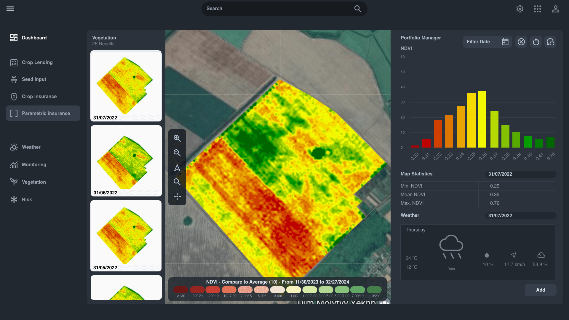
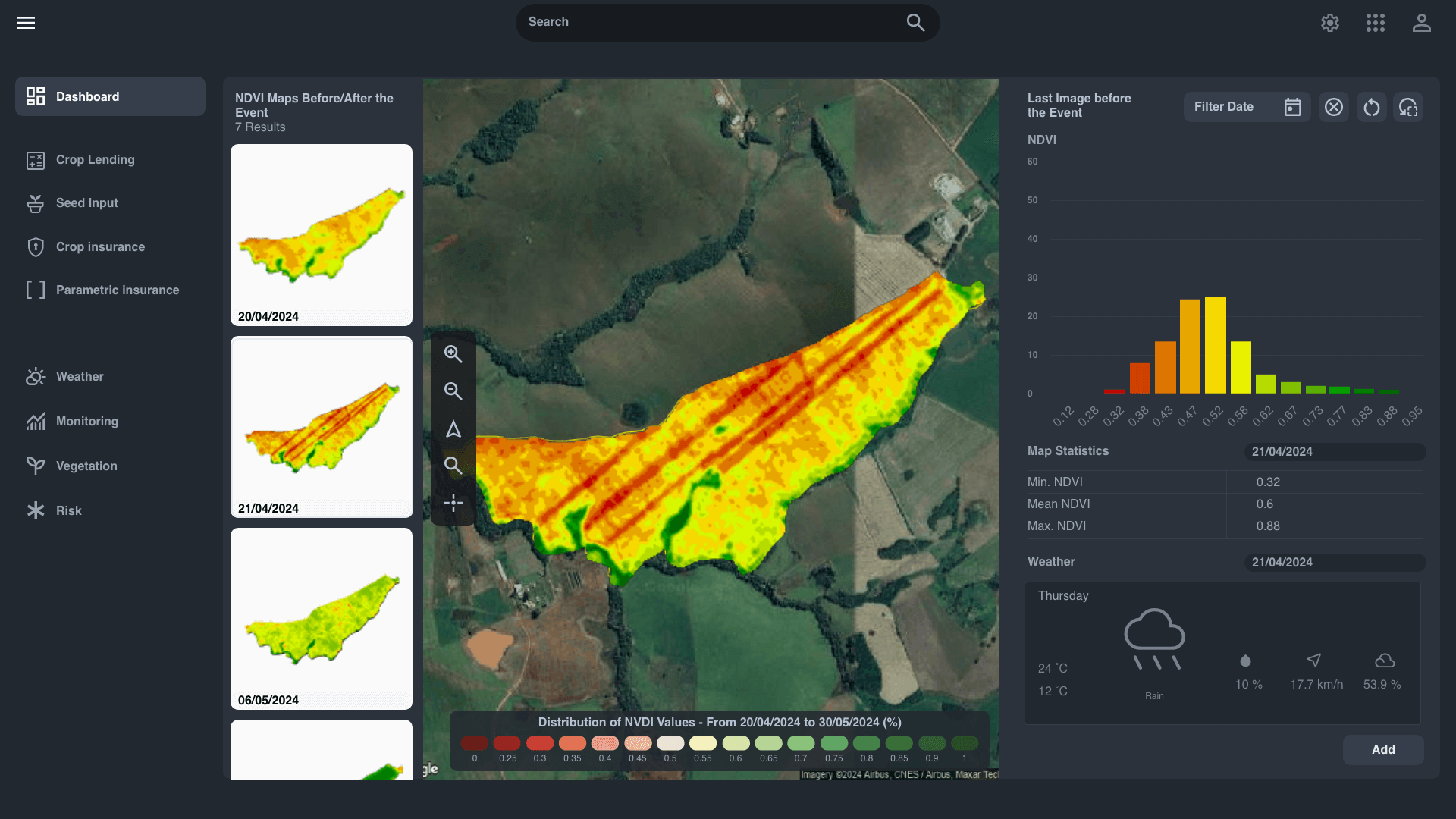
In today's rapidly evolving agricultural landscape, staying ahead requires more than traditional methods. The geosys Platform offers a cutting-edge, cloud-based solution designed to transform raw data into actionable insights, empowering stakeholders across the agriculture value chain.
.png?width=2000&height=1125&name=EarthDaily-Agriculture-Ui-Dashboard%20(1).png)
Why Choose EarthDaily Agro's Expert Service?
Unleashing the Power of Data in Agriculture
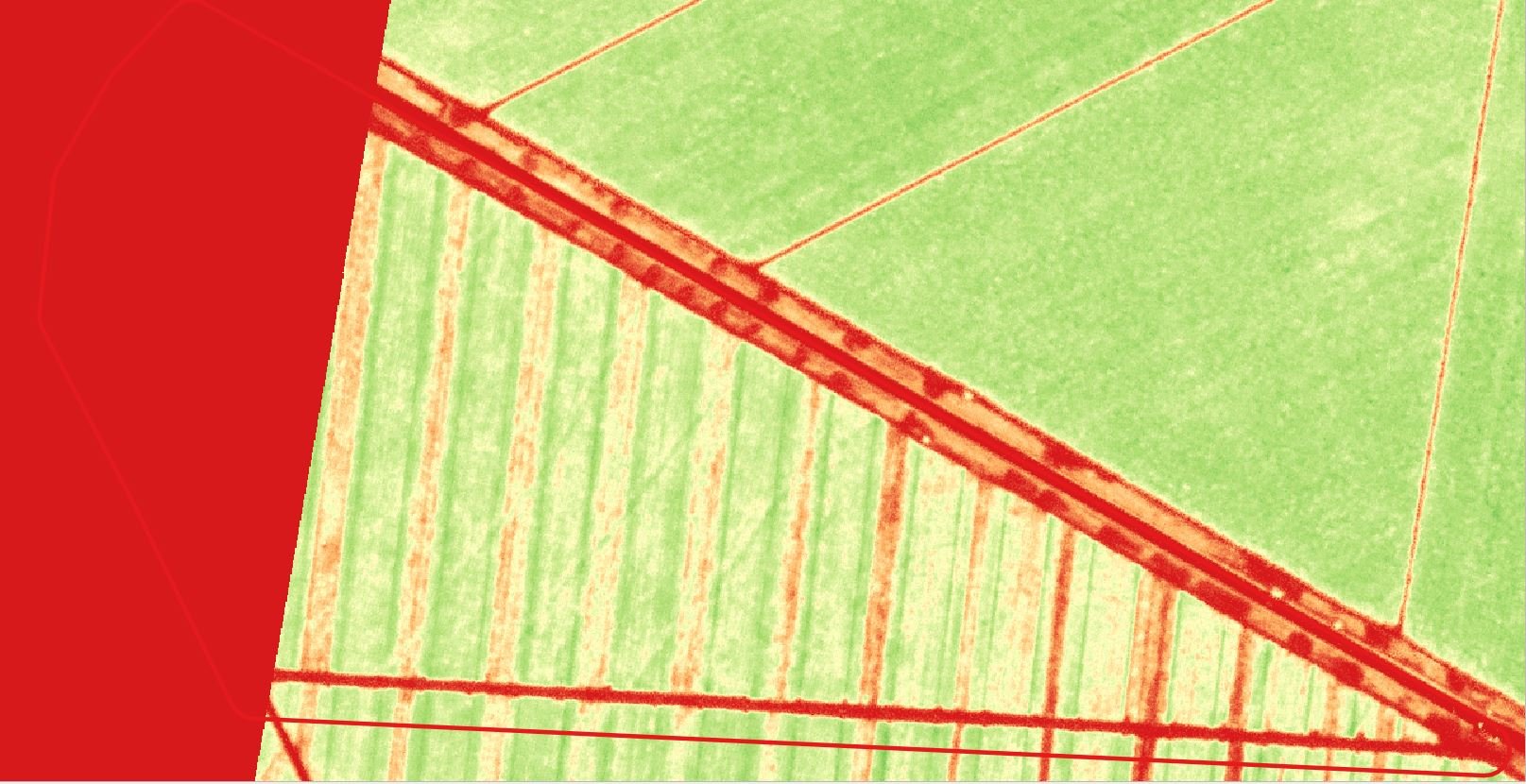
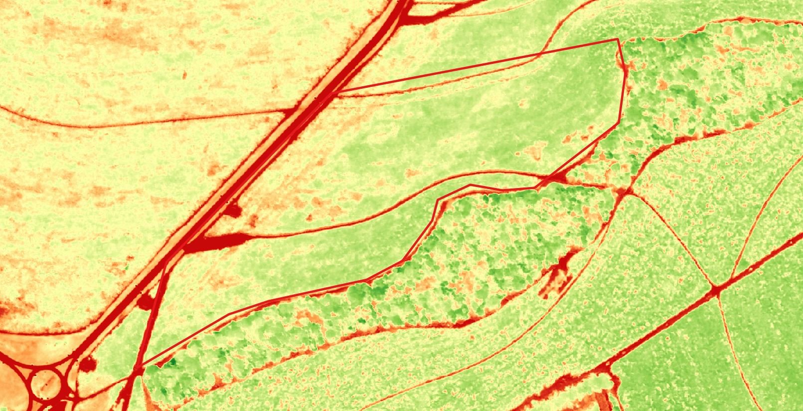
The geosys Platform seamlessly integrates diverse data sources—including satellite imagery from the EarthDaily Constellation, weather data, drone inputs, and user-provided information—into a unified system. This comprehensive approach ensures that users have access to the most relevant and up-to-date information, enabling informed decision-making.
.png)
Advanced Analytics and Machine Learning
Harnessing the latest in artificial intelligence and machine learning, the geosys Platform analyzes vast datasets to identify patterns and trends. This capability allows for accurate yield forecasting, real-time crop monitoring, and proactive risk management, ensuring that users can anticipate challenges and optimize operations effectively.
Tailored Solutions for Diverse Agricultural Needs
The geosys Platform offers specialized modules to cater to various sectors within agriculture:
Digital Agriculture:
Monitor and benchmark fields to optimize input usage and enhance crop performance.
FinTech – Lending and Insurance:
Utilize unbiased, third-party data to minimize risks associated with agricultural financing and insurance.
Commodities Trading & Logistics:
Objectively monitor and analyze crop production to make informed trading and logistical decisions.
Food & Beverage:
Protect your supply chain with proactive monitoring and ensure the quality and consistency of raw materials.
Flexible Data Delivery and Integration
Understanding the diverse needs of its users, the geosys Platform provides multiple data delivery options:
- App: User-friendly interface for on-the-go access to vital analytics.
- Stream: Real-time data streaming for continuous monitoring.
- Dashboard: Comprehensive visualization tools for in-depth analysis.
- Blocks: Modular components that can be integrated into existing systems for seamless functionality.
Explore Our Agriculture APIs
The geosys Platform offers a robust suite of APIs designed to enhance agricultural analytics and decision-making.
Field Vegetation APIs
- Indexes Maps: NDVI (Normalized Difference Vegetation Index), EVI (Enhanced Vegetation Index), CVI (Chlorophyll Vegetation Index), GNDVI (Green Normalized Difference Vegetation Index), LAI (Leaf Area Index), and more.
- Color Composition Maps: True and false color maps used to visualize vegetation cover.
- Vegetation Time Series: Daily measurements of vegetation growth for trend analysis.
Field Agronomy APIs
- Yield Variability and Yield Goal Maps: Analyze past performance and set realistic yield targets.
- Organic Matter Maps: Assess soil organic matter levels for optimized crop management.
- Satellite-Derived Management Zones: Precision ag insights for better field segmentation.
- Elevation and Slopes Maps: Understand topography's impact on crop performance.
-
Nitrogen Application Maps: Crop-specific nitrogen recommendations for wheat, barley, canola, and more.
Weather Data APIs
- Multi-Model Dataset: Access historical, current, and forecasted weather data.
- Aggregation Levels: Data available at administrative units, small agricultural regions, and specific locations.
- Agricultural Parameters: Minimum, maximum, and average temperature, rainfall, wind speed, humidity, snow depth, atmospheric pressure, soil moisture, and temperature.
- Precipitation Data: Daily precipitation insights for better water management.
Notifications and Warnings APIs
- Real-Time Updates: Get information as soon as it is available on our platform.
- New Satellite Image Notifications: Stay up to date with fresh imagery.
- Anomaly Detection: Difference maps highlight unexpected changes in fields.
- Field Benchmarking: Monitor vigor status changes for proactive crop management.
How It Works
Delivering answers to better power your decision-making processes.
Data Sourcing
We collect from a variety of data sources, including our EarthDaily Constellation, which provides a unique and unmatched daily flow of pixels on the entire globe, and supplemental data for weather, radar, drone, statistics, and specialty data.
Multiple Access Options
Choose the delivery based on the user and need: Business Users, Data Scientists, Developers, and third-party systems.
Analytic Ready Data
EarthPipeline technology translates every pixel collected and historical data into comprehensive normalized Analytics Ready Data fit for the Geosys platform.
Delivery Modules
Business Users, Data Scientists, Developers, and third-party systems. Expand and enrich your systems with analytics through our API, Stream, and Blocks.
Advanced Analytics
Combine and interpret analysis-ready data using models highlighting data patterns to create a meaningful insight at scale. Leverage AI and Machine learning to continuously improve detection sensitivity, prediction accuracy, and scalability.
Ready to Get Started?
Empowering an Analytics-Driven Agricultural Future
With decades of proven experience, the geosys Platform is more than just a tool; it's a partner in driving agricultural success. By fostering an analytics-driven culture, it enables stakeholders to make data-backed decisions, enhancing efficiency, sustainability, and profitability across the agricultural spectrum.
